UPDATED: January 2022
Distance: 9.05 Miles RT
Hike Type: Loop
Difficulty: Easy to Easily Moderate
Elevation Gain: 1,241’
Trail Condition: Well maintained and well-marked, mostly wide but narrow at times, muddy
Trail Highlights: 10 waterfalls on the map and 6 waterfalls off the map, waterfalls range from 178 feet to 27 feet, 284 steps, bridges, views of South Fork River, walk behind 4 waterfalls, signs at each waterfall, viewing platforms, dense moss covered forest, restrooms at trailheads
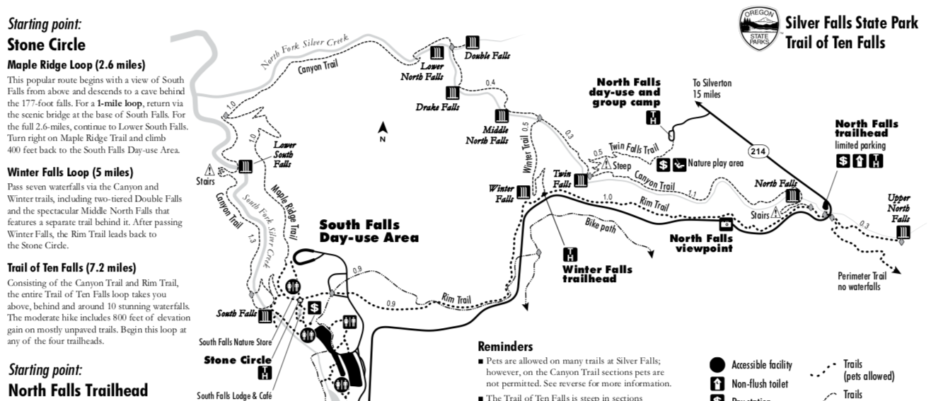
Trailhead(s): South Falls Lodge/Stone Circle Trailhead
Fee(s): Oregon State Park Pass
Dogs Allowed: Must be on leash and within 6 feet + Only on the Rim Trail section, NOT on the Canyon Trail, Winter Trail, Maple Ridge Trail and Twin Falls Trail
Crowd Level: Crowded on weekends, Less crowded on weekdays (outside of summer)
Type of Shoe Needed: Hiking boots or Tennis shoes are fine, but it is wet and muddy
Required Vehicle Clearance: Low, paved the entire way
My Favorite Season To Go: Fall
Jump ahead to the Trail Description.
Adventuring in this Oregon “crown jewel” state park will make you feel like you’re 2,605 miles away in Hawai’i. Walk behind multiple waterfalls and admire towering walls of fern along the 9-mile trail to get the full experience. Or park at one of the main trailheads for a quick spray.
Silver Falls opened July 23, 1933, but the Kalapuya people have lived here since the beginning, and still do today.
Kalapuyan History – Original People
Before colonization the Kalapuya occupied over a million acres in the Willamette and Umpqua valleys. Villages were around the river and streams in the valley. There were 15,000+ people, about 19 tribes and bands total, in 3 distinct areas (north, central, south).
- Northern Kalapuyans: Atfalati/Tualatin, live along the Tualatin River. Yamhill/Yamel, reside along the Yamhill River.
- Central Kalapuyans: Ahantchuyuk, live along the Pudding River. Luckiamute, live along the Luckiamute River. Santiam, lived along and between the north and south forks of the Santiam River. Chepenefa, live along Mary’s River. Chemapho, live along Muddy Creek.
- Other Central Kalapuya tribes in the Eugene area: Chafan, at where Eugene City is. Chelamela/Long Tom, who live along the Long Tom River. Mohawk who live along the Mohawk River. Tsankupi, who live along the Calapooia River. Winefelly, who lived along the Mohawk, McKenzie and Coast Forks of the Willamette River.
- Southern Kalapuyans: Yoncalla or Kommema, live along the Upper Umpqua River.
“The Kalapuyans lived in the same or similar pattern for a long time, a stable seasonal round of regular planned activities. Bands and families would harvest in the same locations every year, in many cases they claimed ownership over specific oak groves or camas fields, or lakes. Many village locations were inhabited by tribal descendants for thousands of years.” – David G. Lewis
Diseases
Malaria hit the area in 1829, and within 5 years 90% of the Kalapuyan population had passed. The original 19 tribes and bands had decreased to about dozen and the population dropped to around 600. By 1851 every piece of land was owned by white settlers who called for removal or genocide of Native American people.
Treaties & Removal
The Kalapuyans signed treaties with the United States on at least 4 occasions.
- 1851: Tribes of the Willamette Valley signed treaties which allowed for the creation of permanent reservations within their homelands. These treaties were not ratified by Congress.
- 1854: Yoncalla and the upper Umpqua signed a treaty which removed them to the Umpqua Reservation. Tualatin also signed a treaty this year that was never ratified.
- 1855: Tribes of the Willamette Valley, Kalapuyans, Molallans and Clackamas-Cascades-Wappato Island (Multnomahs), signed the Treaty with the Kalapuya Etc. and moved to temporary reservations.
11 different locations became temporary reservations. Local farmers had Tribes work to live. Tribes built fences, helped develop the farms, and worked in agriculture for about 12 months.
- 1856: Were removed to the Grand Ronde Indian Reservation and population continued to decline. The Kalapuyan peoples mingled with at least 29-35 other Tribes at the reservations. And by 1900 there were about 300 Kalapuyan members remaining.
Today the majority of Kalapuyan people are members of the Confederated Tribes of Grand Ronde.
1950’s: Confederated Tribes of the Grand Ronde Indian Reservation were terminated, and elders worked to be restored during the 1970’s.
Source: Kalapuyan Tribal History
Establishment of the Park
The state park was established thanks to June Drake.
- He worked on convincing others to make this area a national park from 1906 until 1926, but had no luck.
- June Drake took photos of the area and falls and then showed them to Samuel H Boardman. His photos were so beautiful that he was able to gain Samuel H Boardman’s support.
- Then he enlisted Silverton and Salem Chambers of Commerce to buy options on parcels to sell to the state.
- Drake also purchased 160 acres of the land with his own personal money.
In 1934, Samuel H Boardman started developing Silver Falls and the main lodge. The National Park Service then began to buy land around city centers and turn them into “Recreation Demonstration Areas” (RDAs).
- There were 46 RDAs created in the United States and Silver Falls is one of the only two located on the west coast.
- The goal for Silver Creek’s RDA was to restore a former area of natural beauty to as close as its original state as possible.
Waterfall Order and Stats
1) Frenchie Falls – 48 feet, named after the 1960’s assistant of Silver State Falls Park Roland “Frenchie” Lecompte
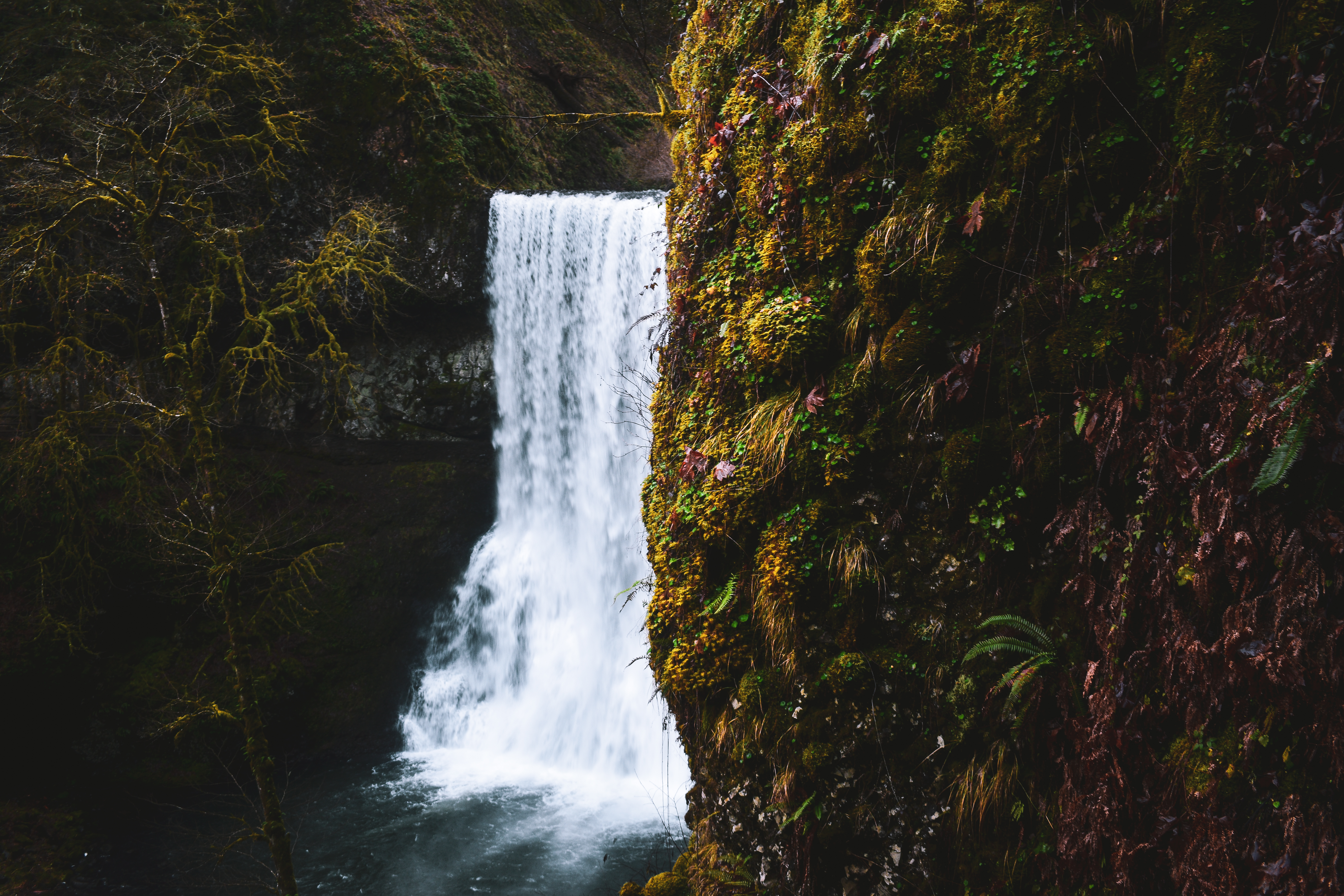
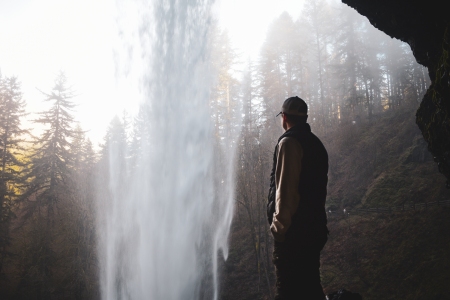
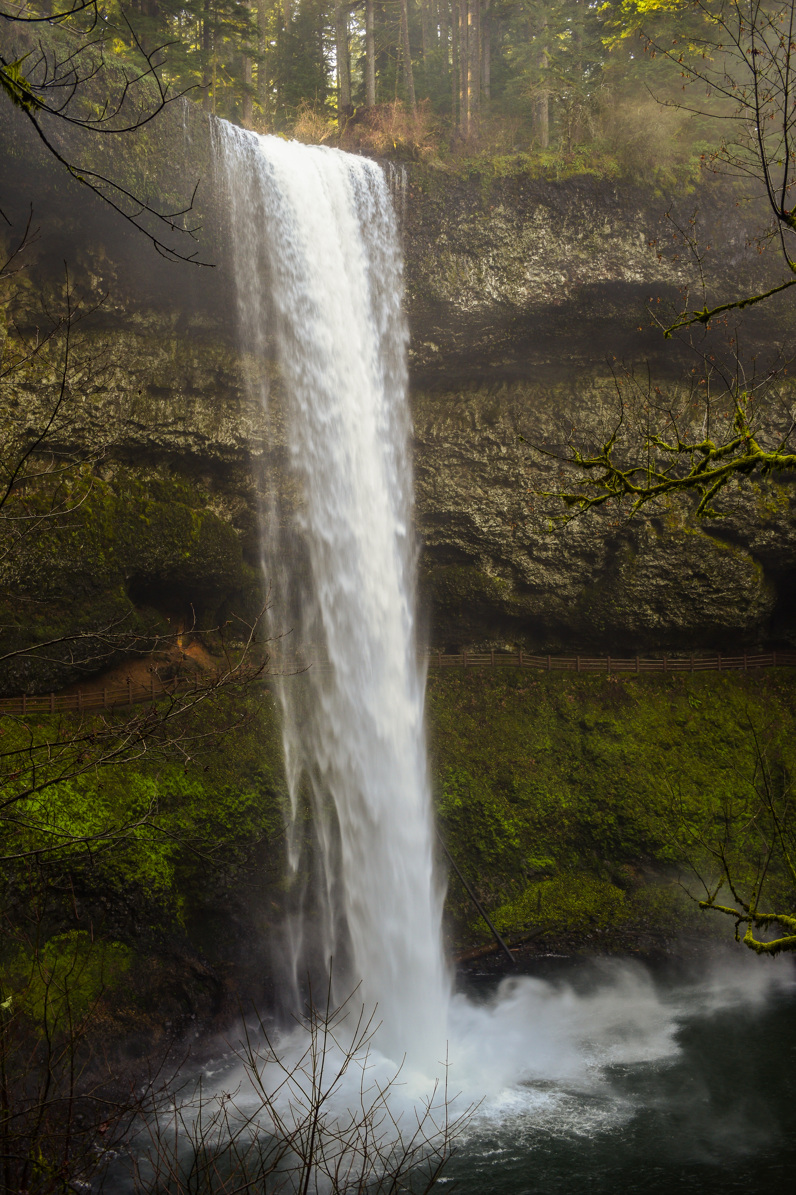
2) South Falls – 177 feet, walk behind the falls
3) Lower South Falls – 93 feet, walk behind the falls
4) Unnamed Waterfall – flow depends on the season
5) Lower North Falls – 30 feet, nicknamed “The Thunderdome” among the white river kayaking community
6) Double Falls – 178 feet, tallest waterfall in the park by a hair
7) Drake Falls – 27 feet, the shortest waterfall in the park, named after June Drake
8) Middle North Falls – 106 feet, walk behind the falls
9) Twin Falls – 31 feet, during the wet season there is two veiling curtains
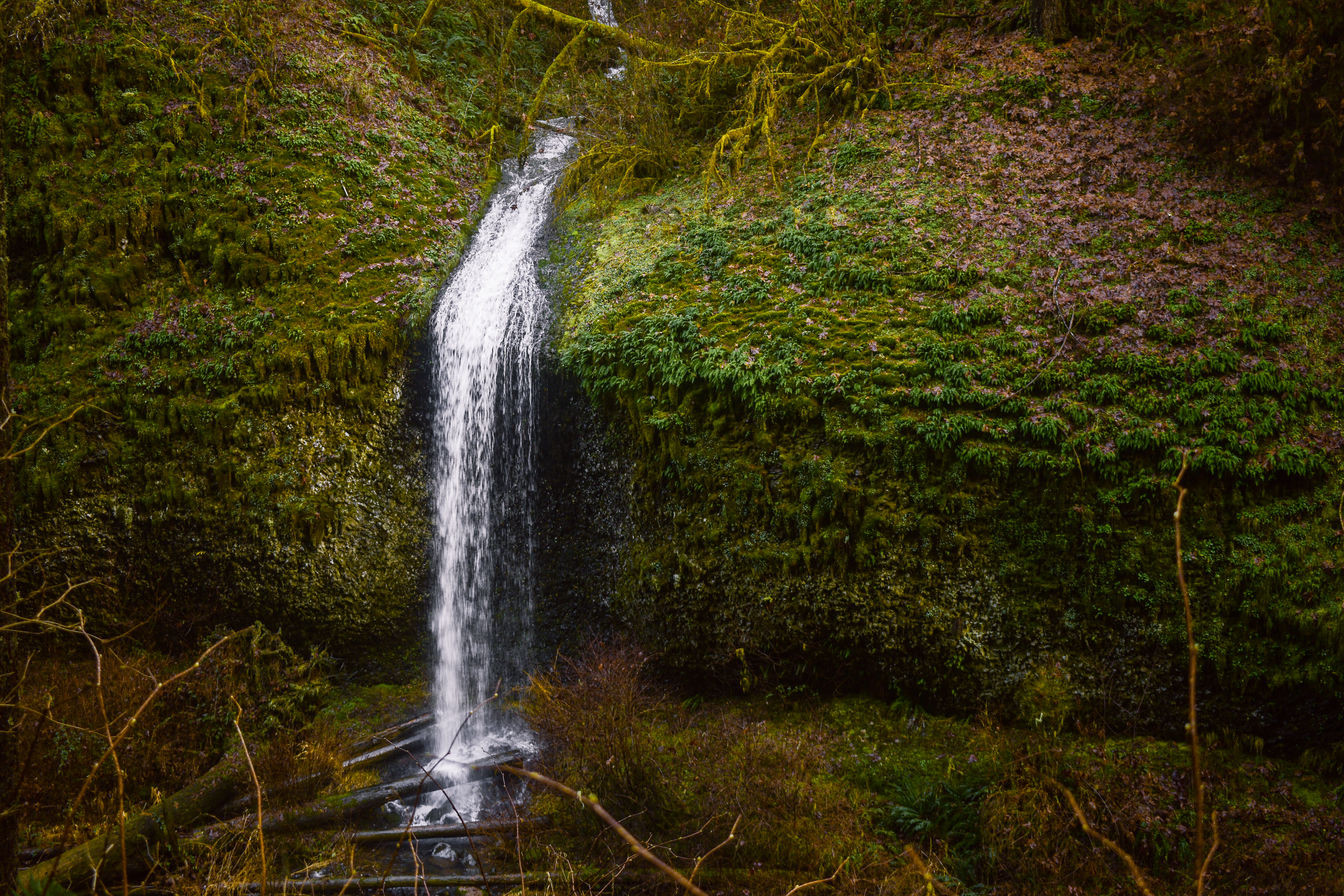
10) Elbow Falls – 20 feet
11) Canyon Falls – 10 feet
12) Lisp Falls – 5 feet
13) Sunlight Falls – 5 feet
14) North Falls – 136 feet, trail behind falls
15) Upper North Falls – 65 feet
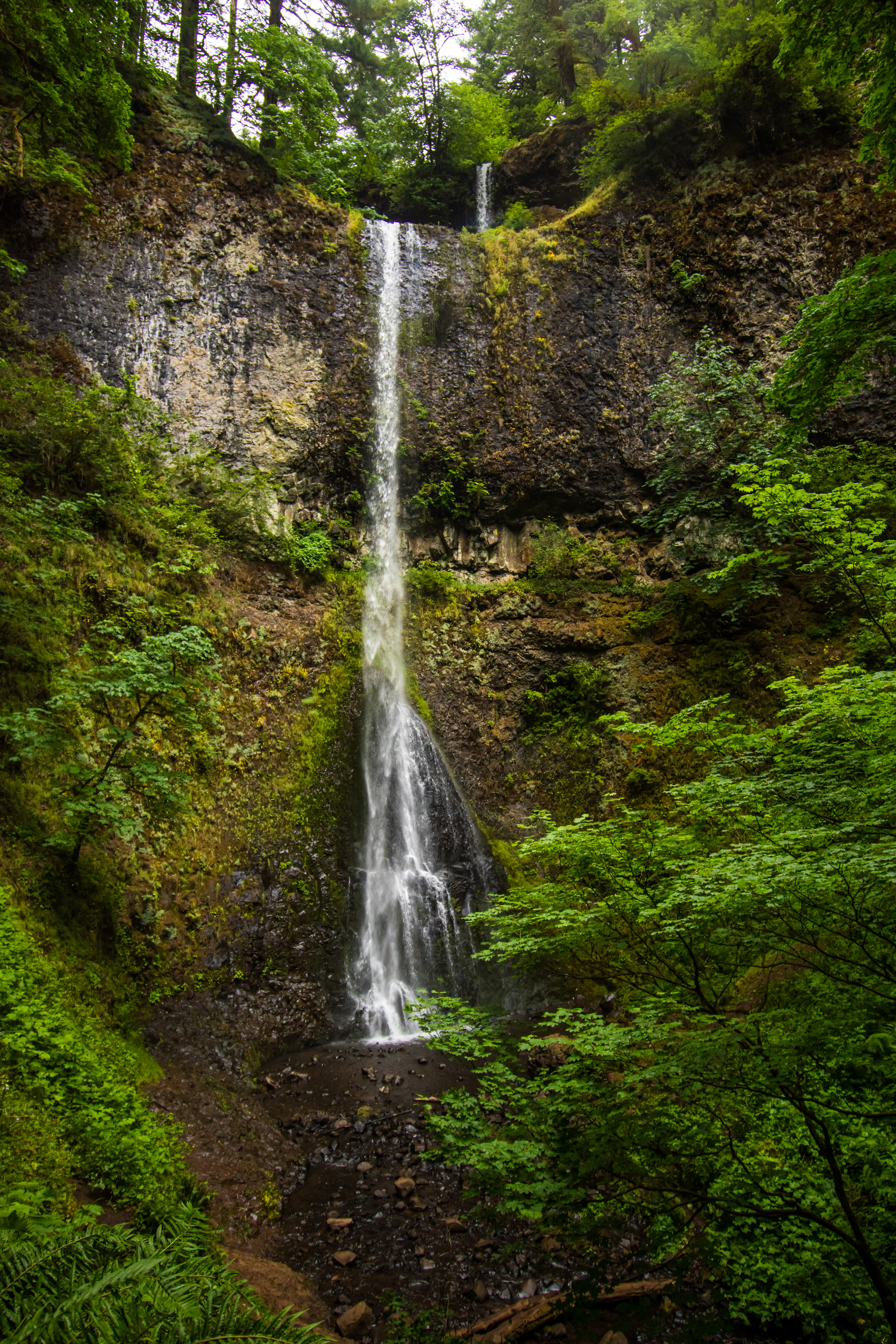
16) Winter Falls – 134 feet, only flows during the wet months, named for its seasonal behavior
Food & Gifts
If you are hungry while visiting you can stop at the park’s café, South Falls Lodge Café. The café serves American type food (sandwiches, salads, etc), coffee, alcohol and ice cream! There are wooden chairs outside in the lawn that you can relax in and soak in the park views. A nature (gift) shop is also located in the South Falls Day-use Area as well! Friends of Silver Falls also offer tour guides of the hike if that is more your style.
Hours
Park Hours
- February: 8AM to 6PM
- March: 8AM to 8PM
- April – August: 7AM to 9PM
- September: 7AM to 8PM
- October: 8AM to 7PM
- November – January: 8AM to 5PM
*COVID-19 has affected operating hours. Please check the website or call ahead of time.*
Pet & Wildlife Info
Pets are welcome to most areas of the park, BUT not everywhere.
Where Pets Are NOT Allowed
Pets are not allowed on the Canyon Trail or any of the connecting trails Winter Trail, Maple Ridge Trail and Twin Falls Trail.
Where Pets ARE Allowed
- Off-leash area located in the South Falls Day Use Area. Must be kept on a six-foot leash in all other areas.
- Upper North Falls is a pet-friendly waterfall!
- A 65-foot cascade where your dog can swim in Silver Creek.
- South Falls can be viewed with pets, but they cannot go behind the fall and further on trail.
- 35+ miles of backcountry trails.
- Rackett Ridge, Perimeter and Buck Mountain Loop.
The map at the bottom has highlighted trails that dogs are allowed on.
*Any more questions please ask the staff!
Silver Falls is also home to black bears, deer, bobcats and cougars.
- If you come across an animal do not approach it (avoid from filming as well to stay alert). The pamphlets around the park have tips on what to do during an animal encounter.
- If you see any, please report it to the park rangers.
You can fish here, but it is all catch and release only, barbless hook.
- You must have a license through the Oregon Department of Fish and Wildlife.
- Please do not leave the trail to cast a line.
- For more specific information visit the Oregon Department of Fish and Wildlife website.
Camping Info
All campsites are based on reservations. Reservations can be made 9 months to 24 hours prior to check in.
- Firewood is available for $5 a bundle and a bag of ice costs $2.
- Go to Reservations Northwest or call 1-800-452-5687.
- To reach the Registration Booth call 503-873-8681 extension 31.
Friends of Silver Falls
You can also volunteer here if you’d like! They ask that each volunteer dedicate 8 to 16 hours a month. There are volunteers for the nature store, events and the trails.
- Check out their volunteer page for more info! Email: admin@friendsofsilverfalls.net
Did you know?! When Silver Falls Start Park was first transferred to the State of Oregon it was only 6,300 acres?! Today the park is 9,057.81 acres.
Trail Description
To get started, park at the South Falls Day-use Area parking lot. This is a big parking lot that has a picnic area and more. A self-pay kiosk is in front of the restrooms next to a big sign – you can’t miss it.
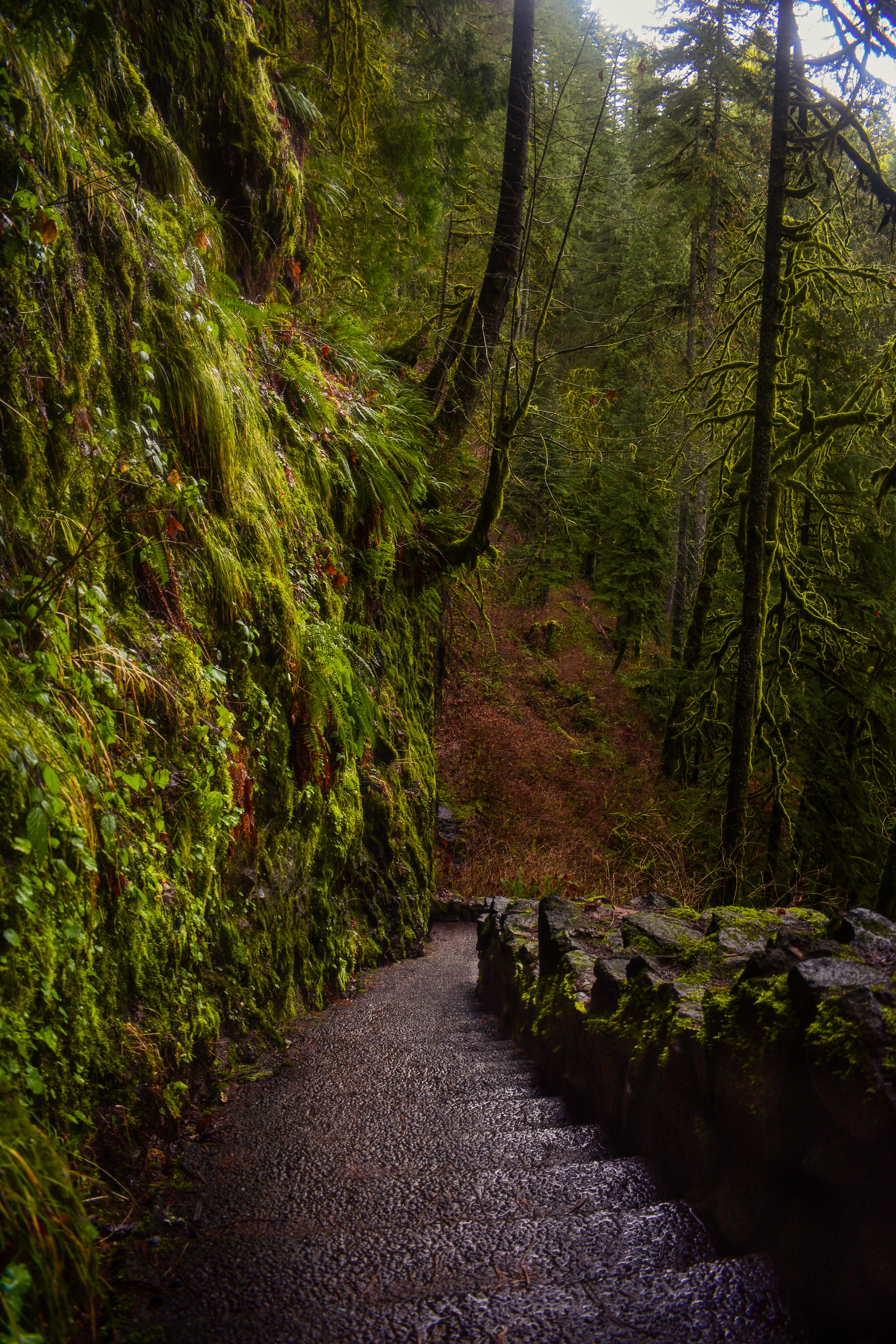
Pass the restrooms on the left, the cafe on the right and follow the path. You’ll soon come to Stone Circle Trailhead (the paved circle) and head to the left towards Canyon Trail. The Nature Store will be on the right side.
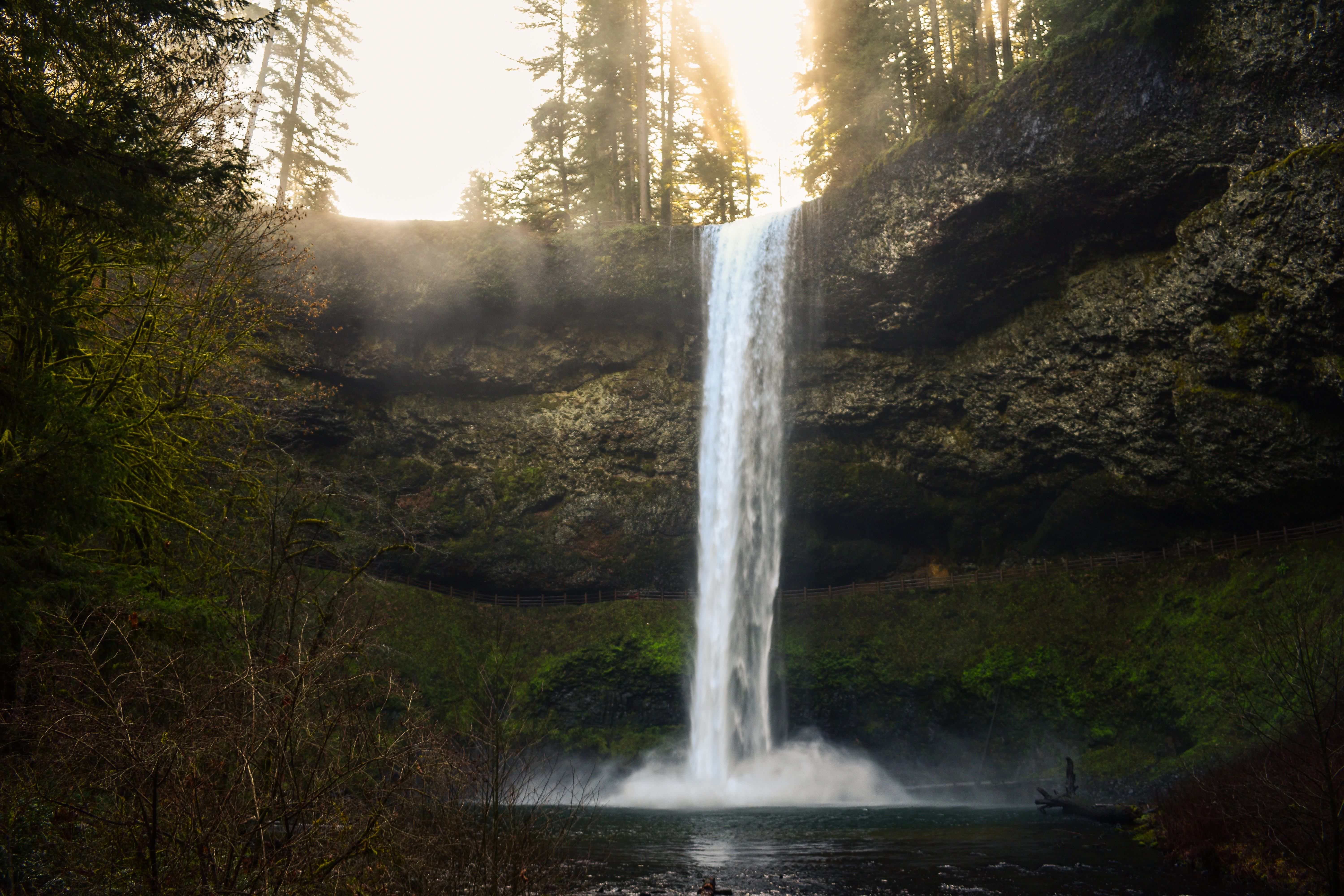
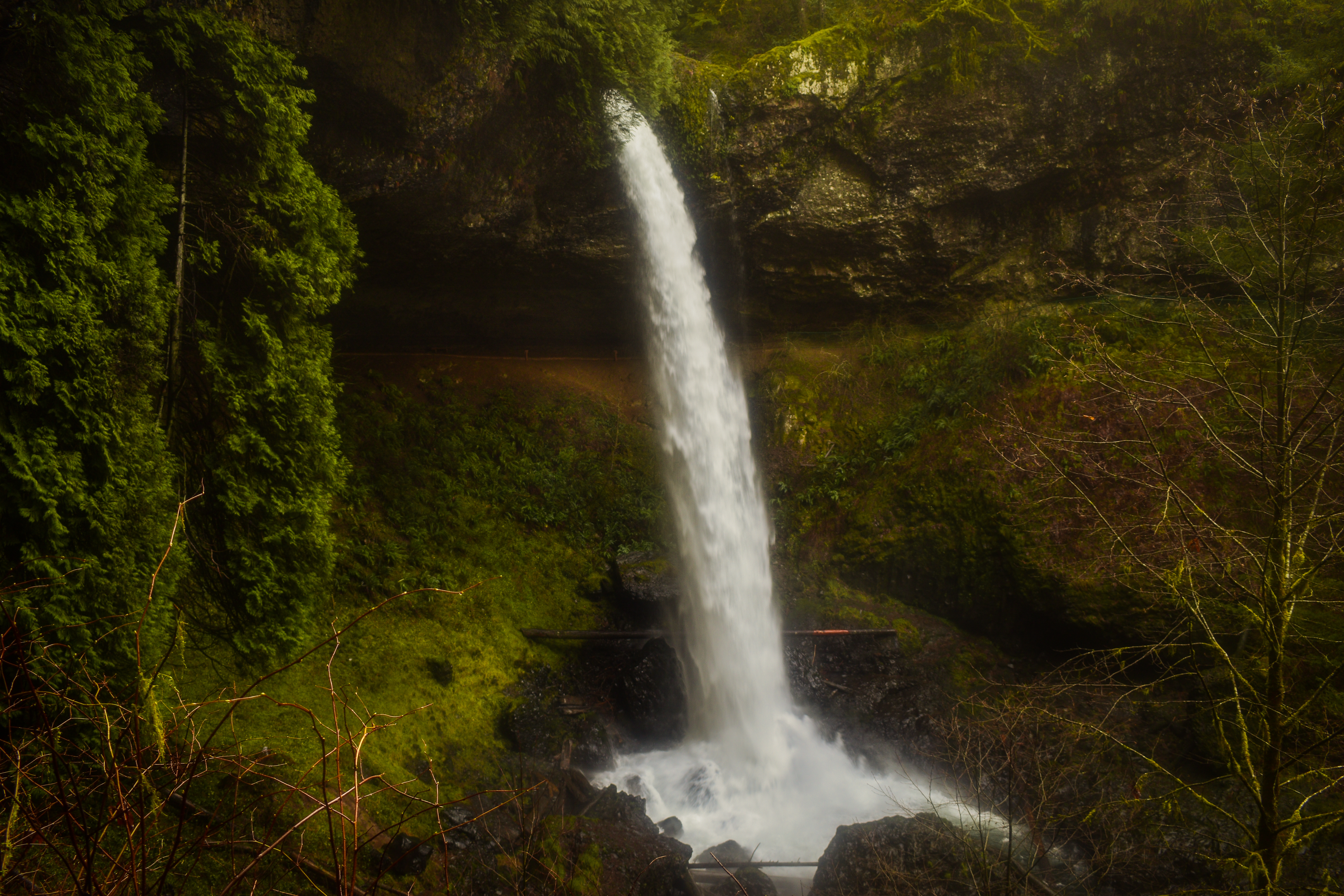
The trail is clearly marked, so just make sure to follow the Canyon Trail signs down to South Falls. The signs will be on your left. Descend down the trail to get to the bottom of the 177-foot South Falls.
Keep an eye out for a sign on your right for Frenchie Falls. Take this right for the first waterfall of the trail!
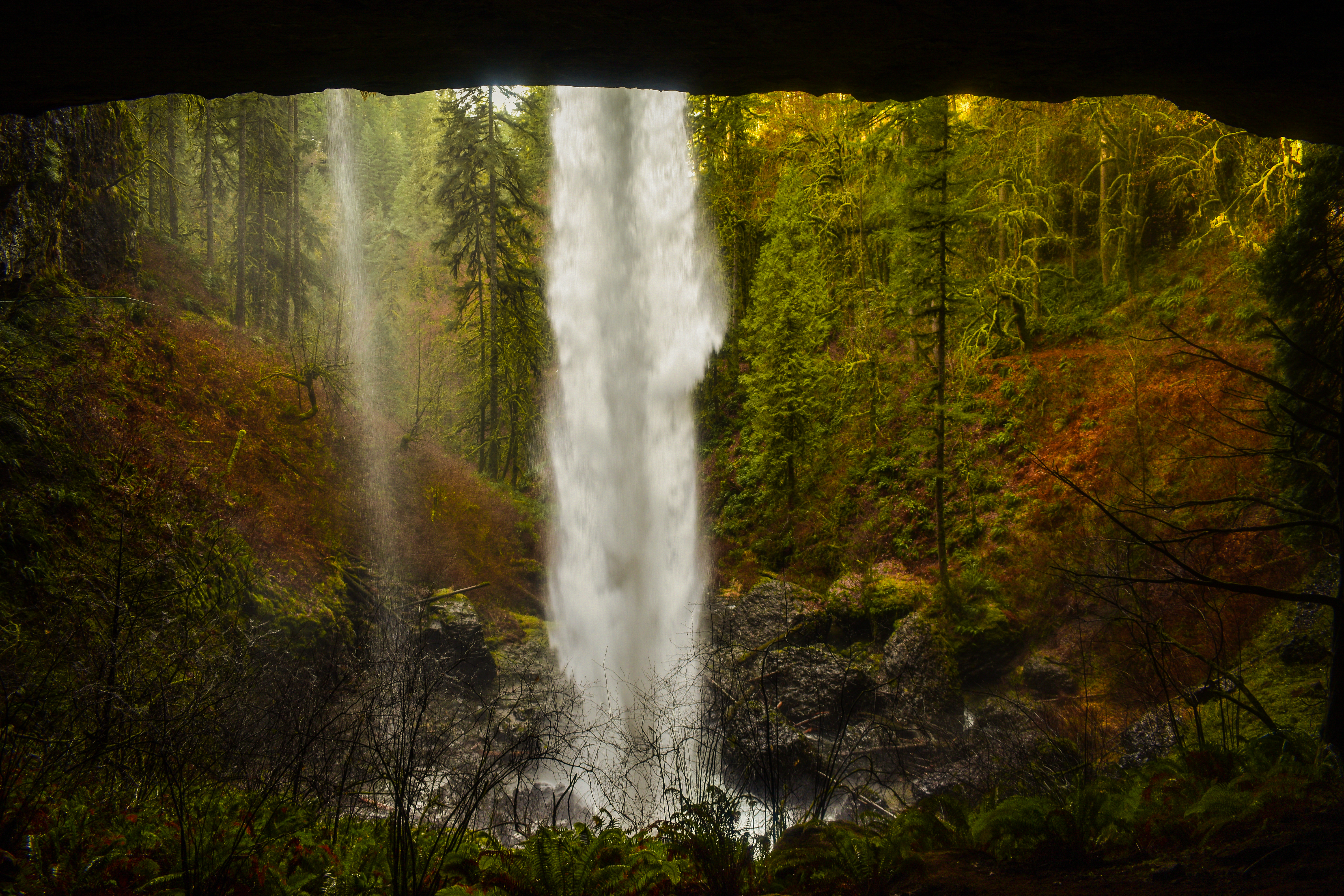
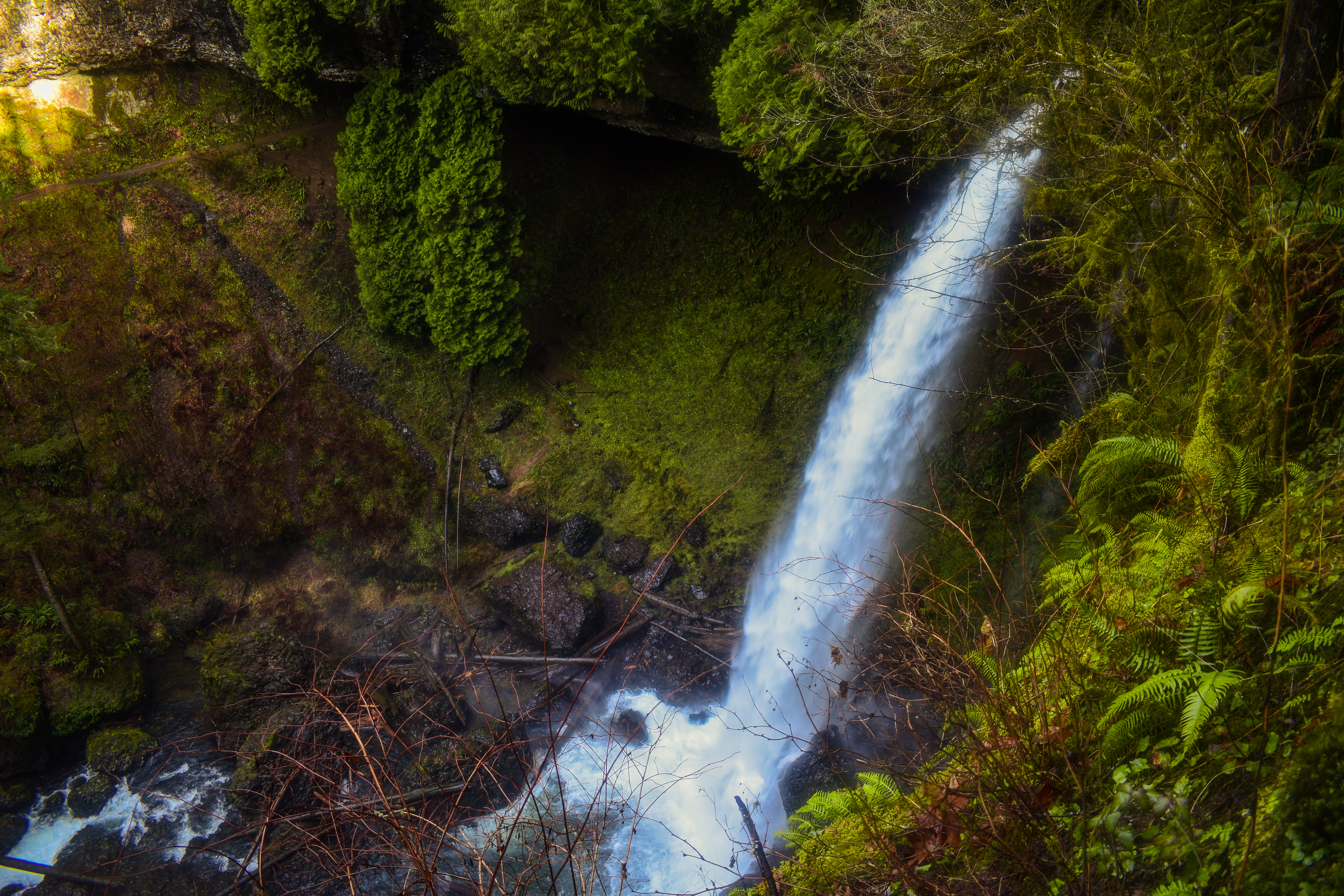
Then continue down to the trail to South Falls. This is the first waterfall you’ll walk behind! South Falls is also the most popular waterfall on the trail. Once you’re out from behind the fall the trail will drop back down.

On the right there will be a bridge that you can walk across and get a full view of the fall. Do not continue across this bridge, turn around and…
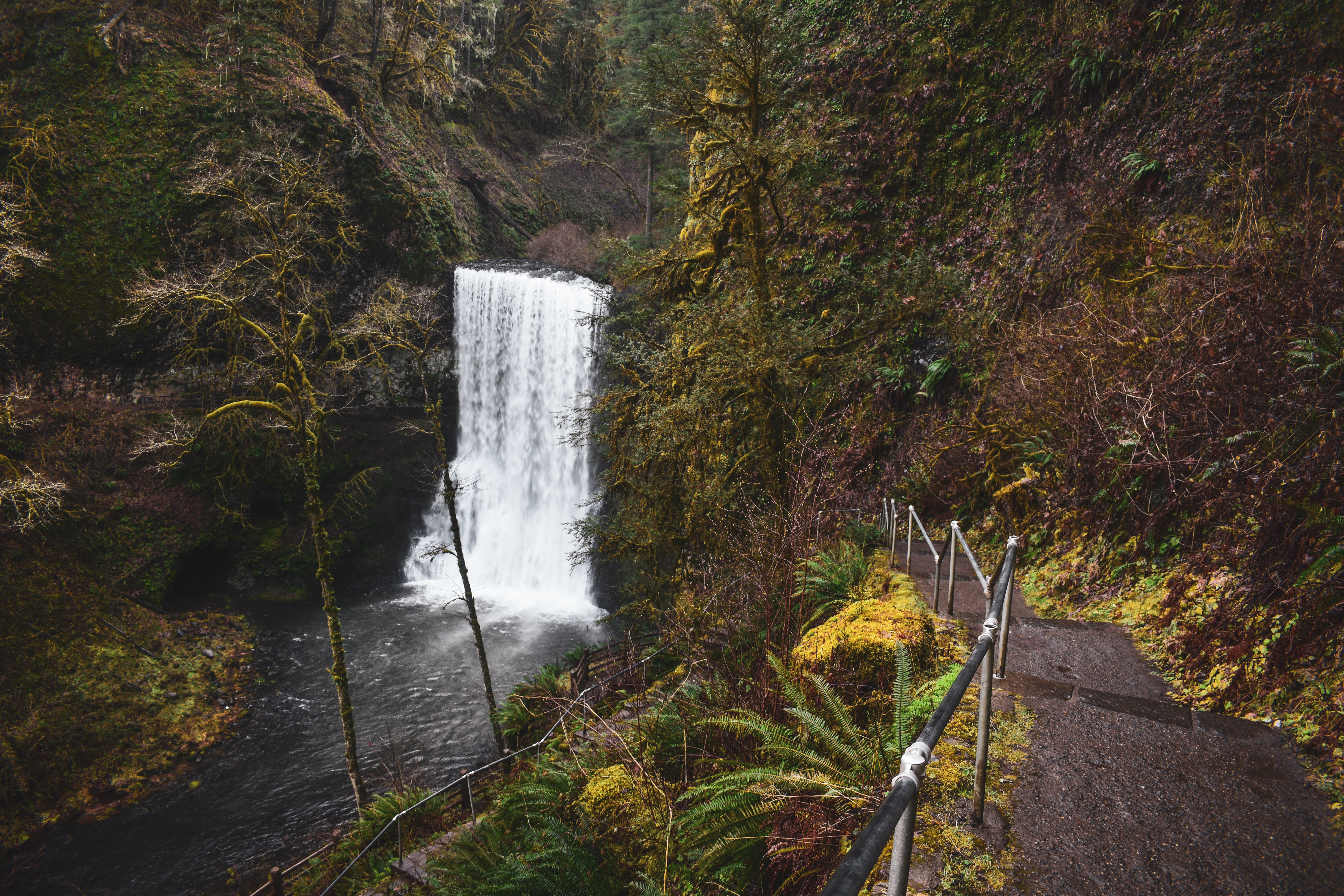
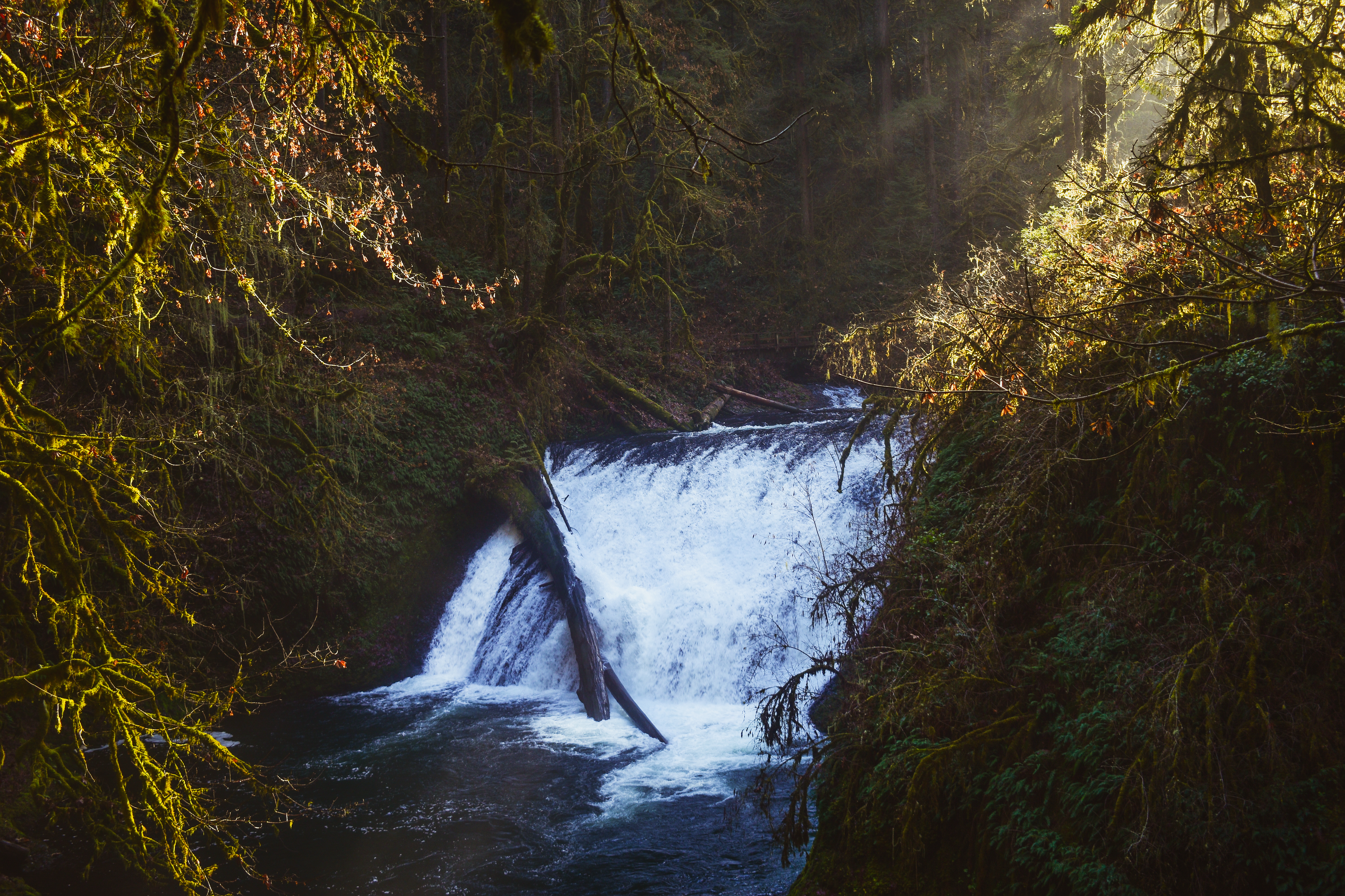
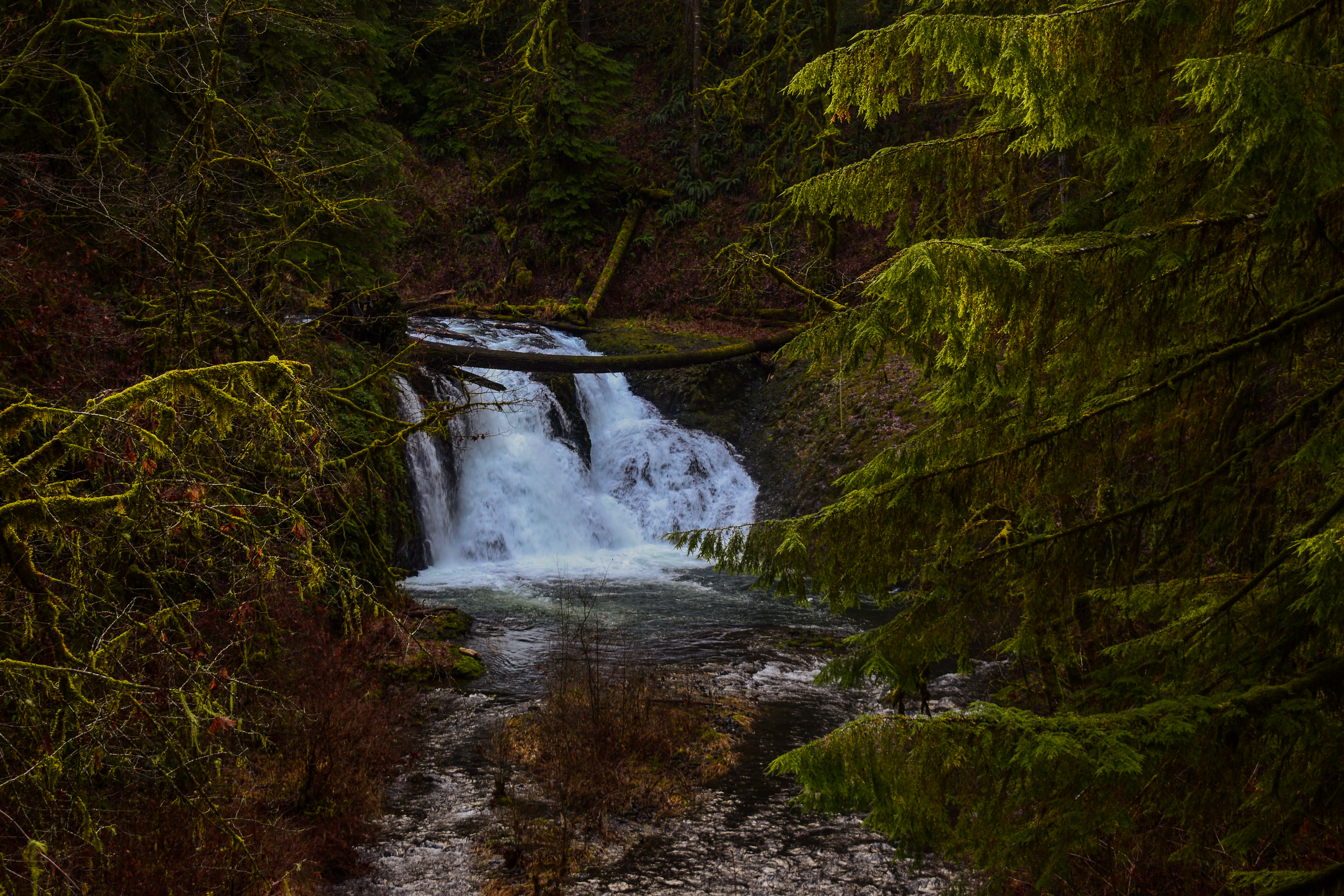
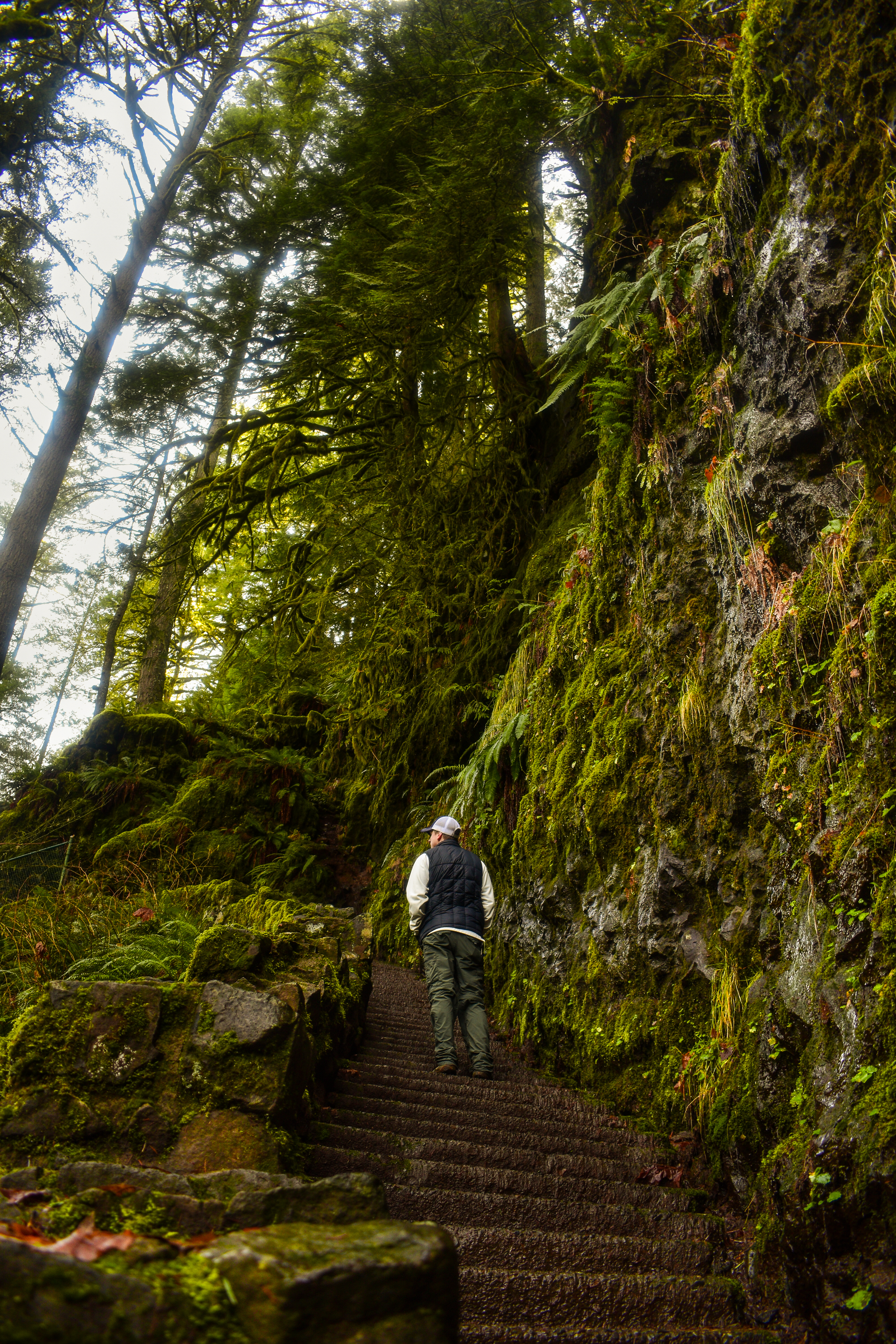
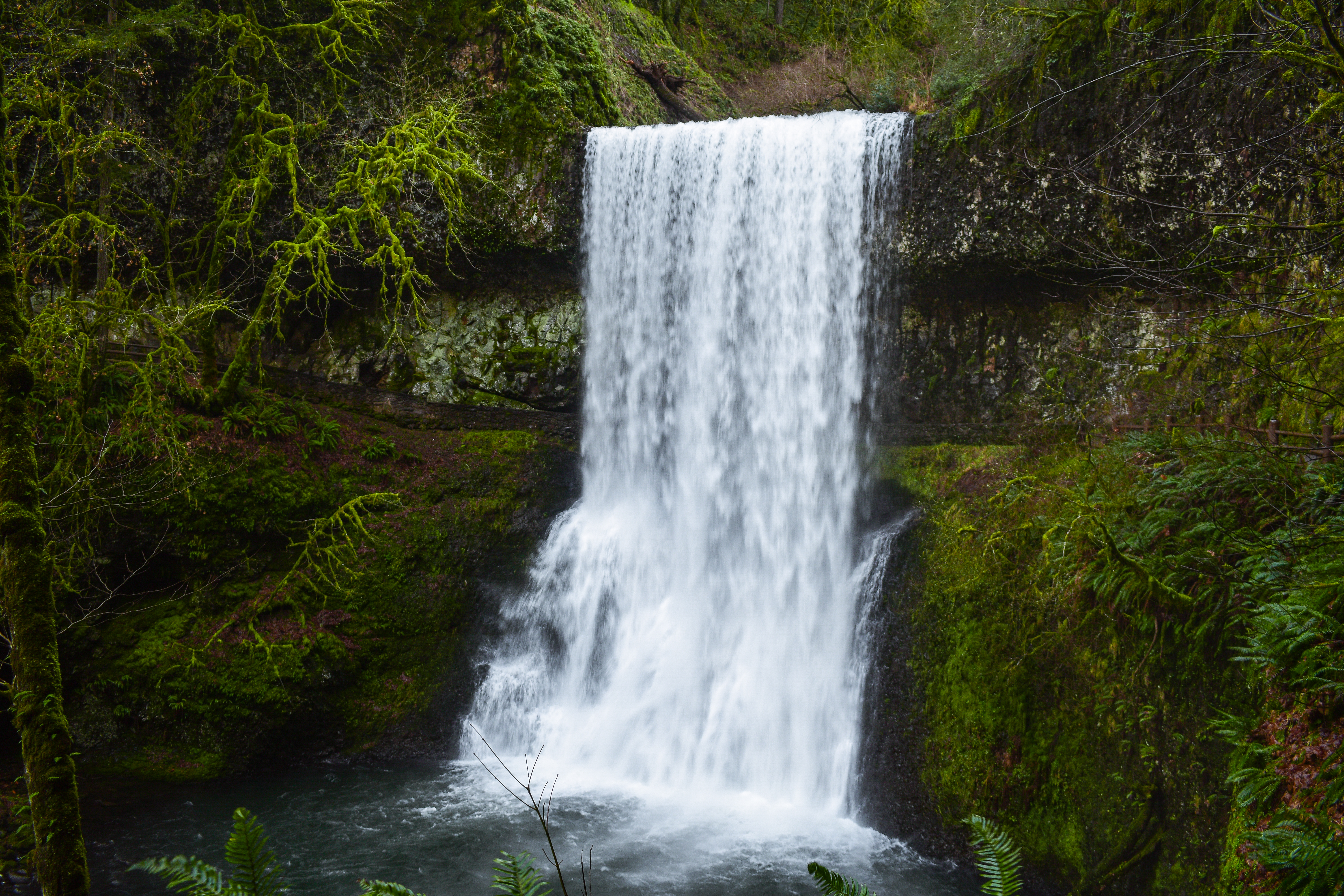
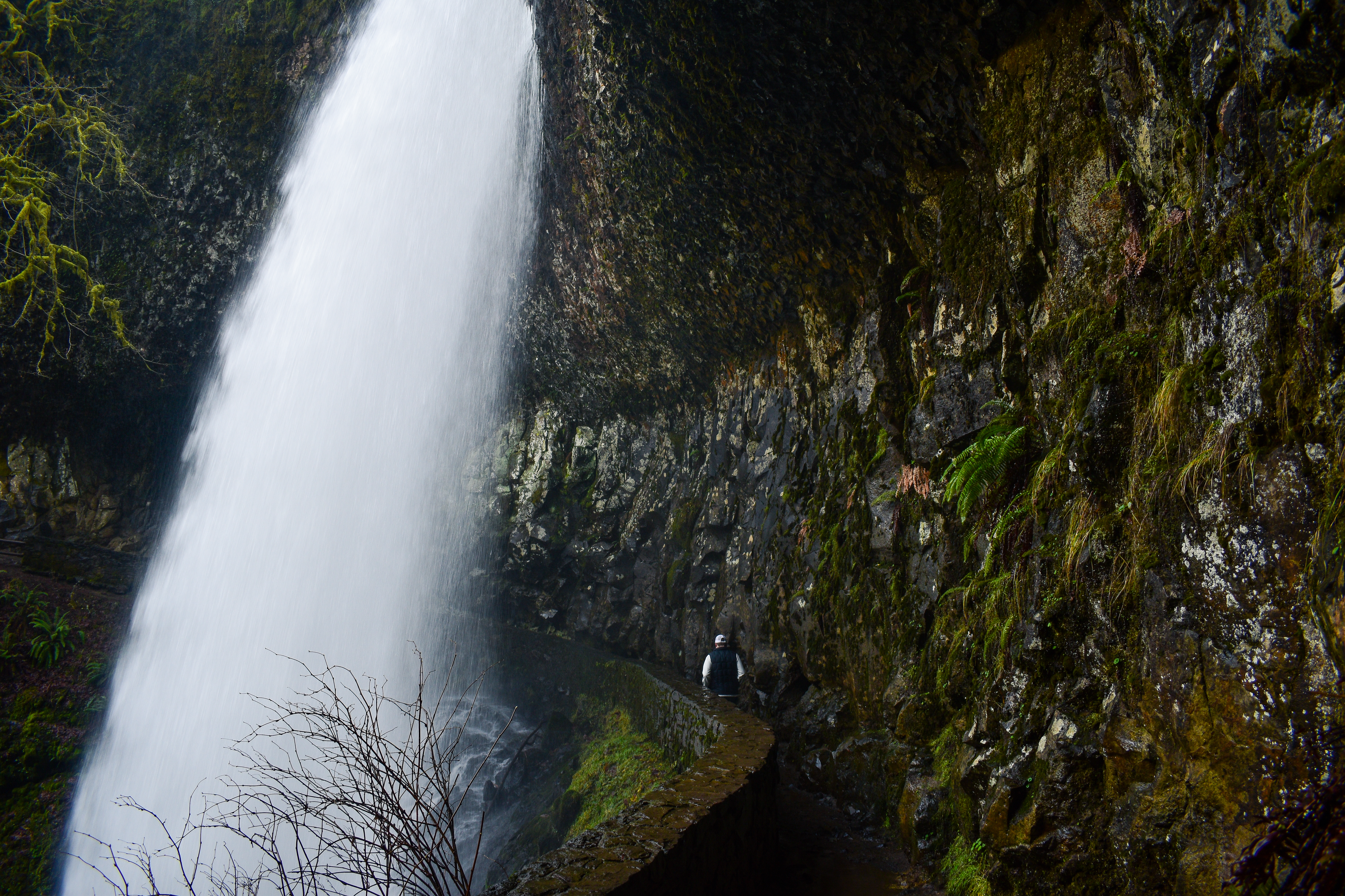
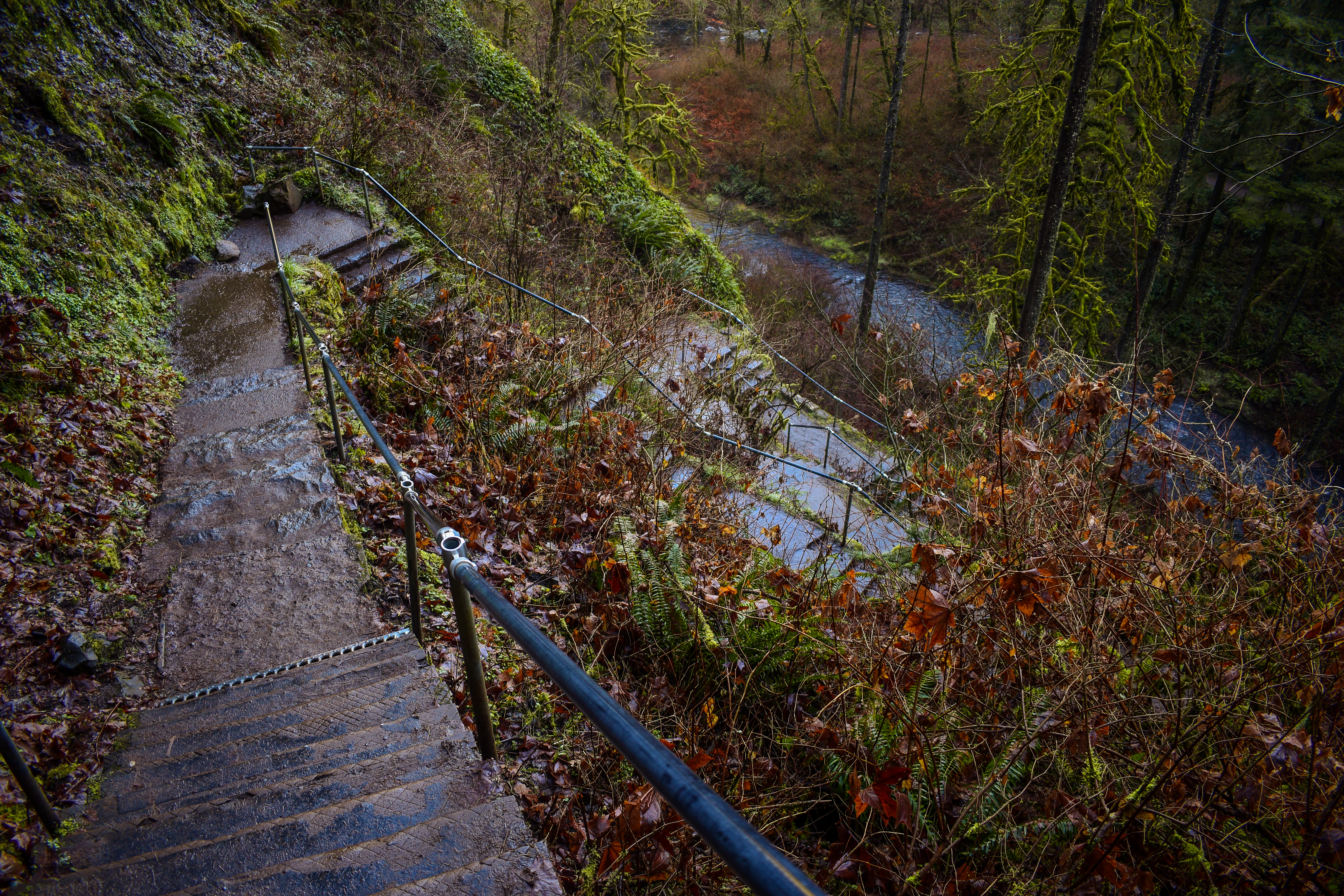
continue down the trail for another mile before you reach the stairs that lead you down into the canyon. Nick and I counted 187 steps here, give or take. Halfway down the stairs Lower South Falls will come into view. After the stairs (and at 1.25 miles) you’ll walk behind the waterfall. It can get a bit wet behind this one.
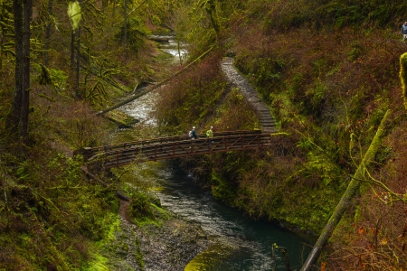
Keep following the trail and stay left (do not go on the Maple Ridge Trail on the right). Half a mile past this section there is a seasonal unnamed waterfall (not on the map) on your left! It is here as of January 27, 2019 & June 28, 2020. The trail loses elevation and at 2.3 miles you’ll walk across the Lower North Fork Silver Creek Bridge.
Then you climb for a bit and see Lower North Falls on the right. Shortly ahead there will be another footbridge, take a left here to go see Double Falls. When you’ve had enough, turn around and head back to the main trail.
Take a left back on the main trail and ascend for about a tenth of a mile. At the top of the hill Drake Falls pops up on the right. The view isn’t the greatest, so be sure to go out on the small viewing platform.
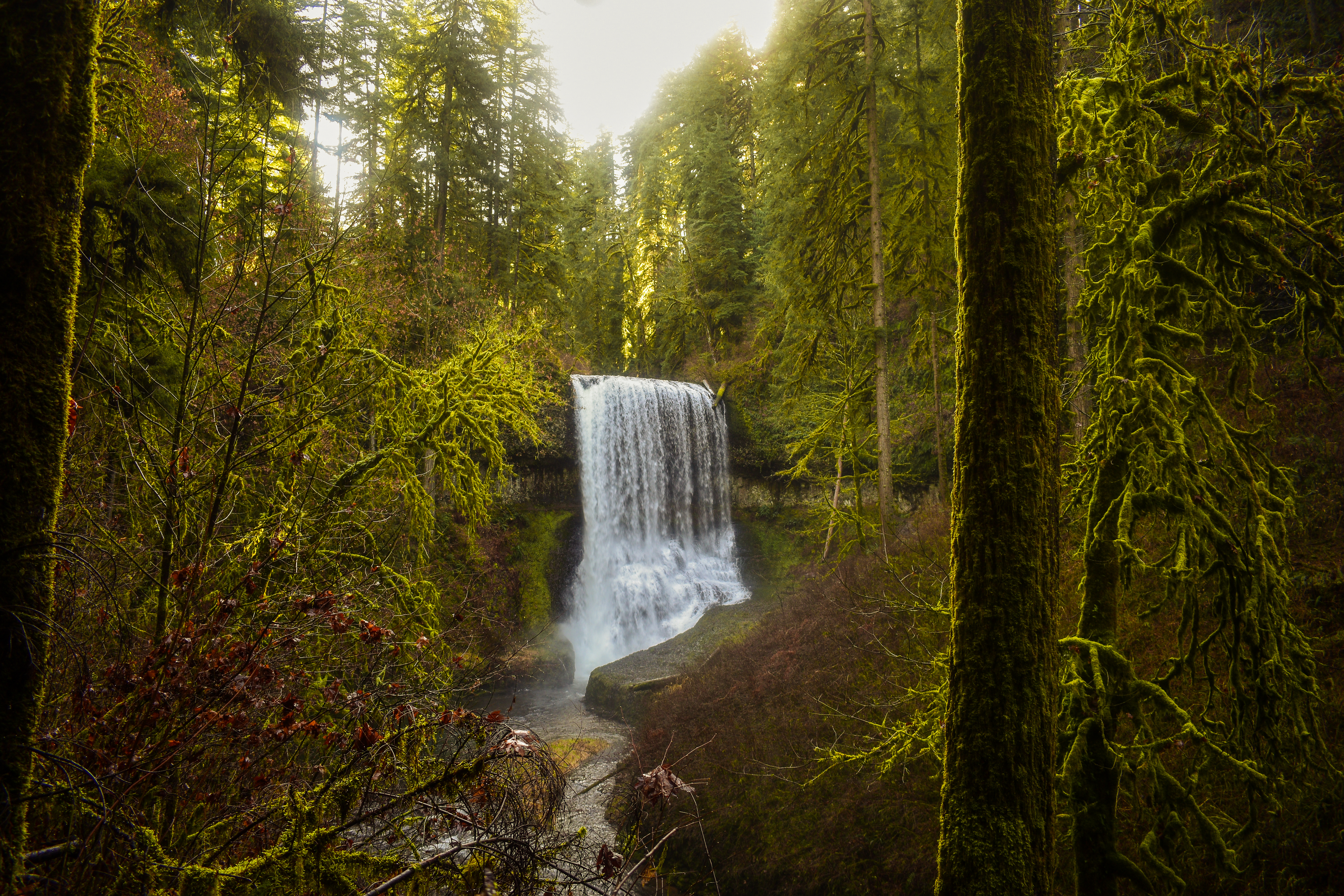
0.2 miles past Drake Falls there is a split in the trail that leads to Middle North Falls. Take a right here to walk behind and to the other side the waterfall! This is the third waterfall you’ll walk behind. Return to the main trail after venturing down this side trail and continue the loop. This is the 3 mile mark.
Soon Winter Trail junction (and a bridge) is on the right, but continue straight. Don’t go over the bridge. 0.30 miles down the trail Twin Falls will be on your right. Unlike Double Falls, Twin Falls are side by side. Just past Twin Falls is the Twin Falls trail, ignore this path and stay right.
During the next 0.8 miles there are some waterfalls on the left and right that are not on the map (Elbow, Canyon, Lisp, Sunlight).
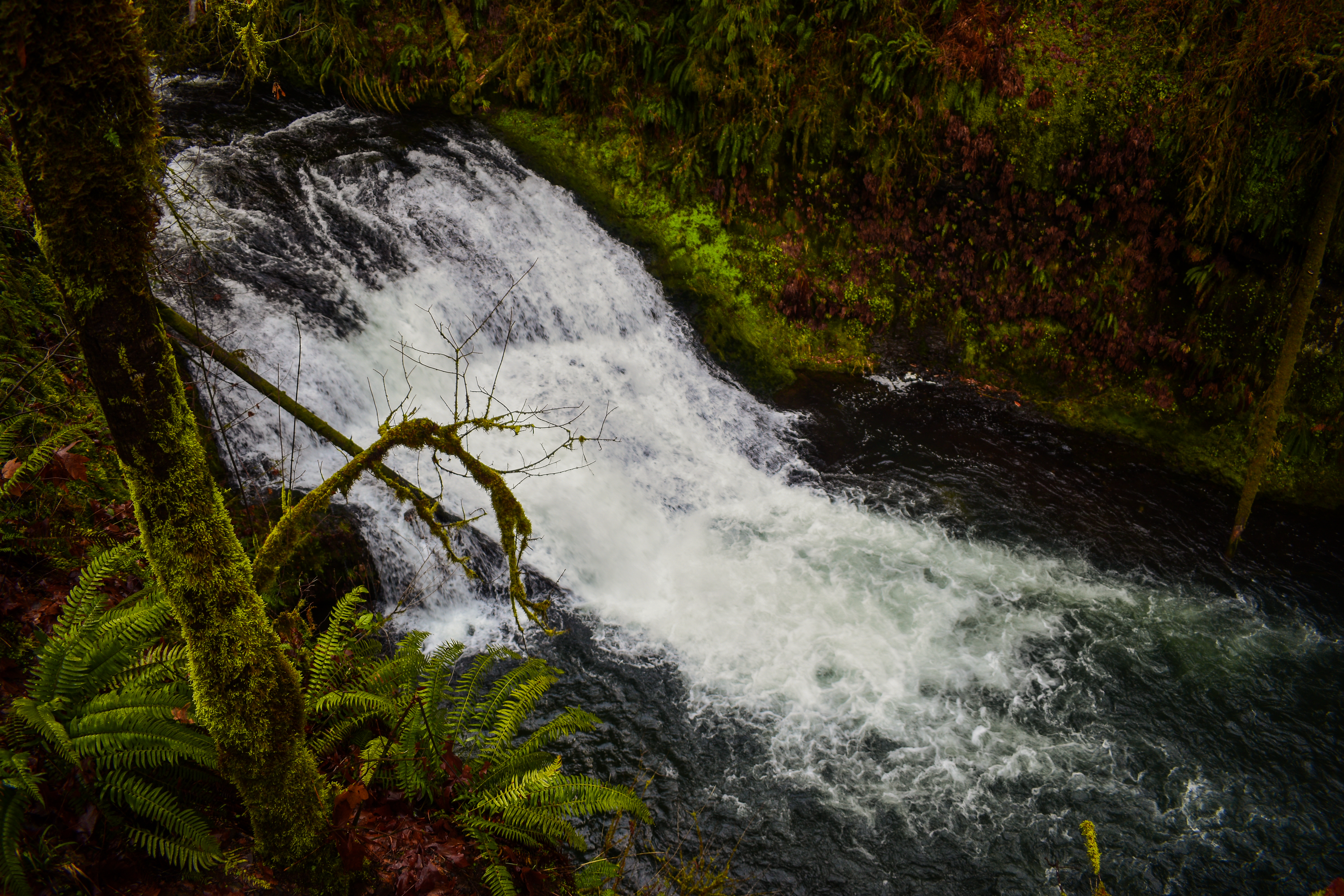
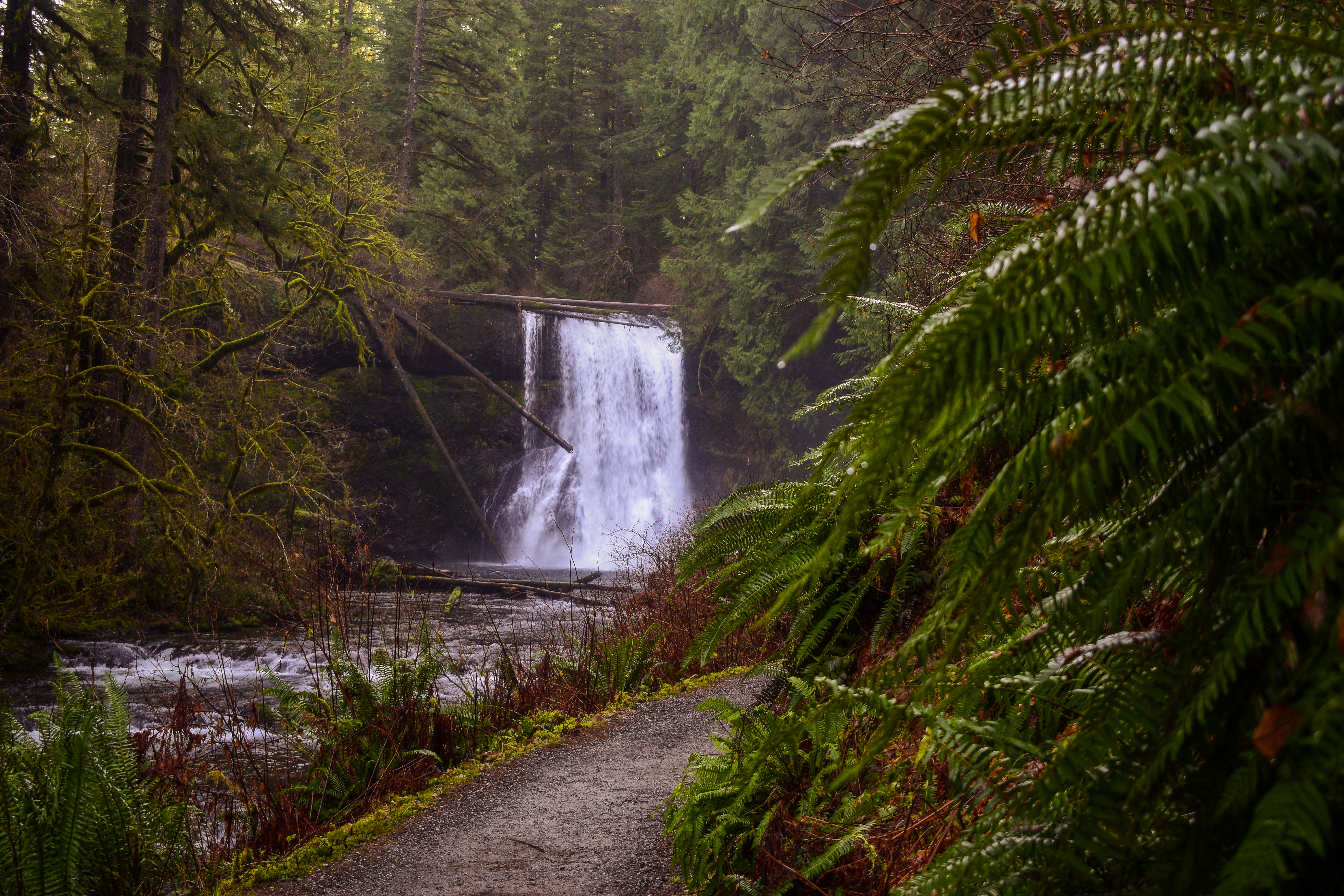
In 1.1 miles the big North Falls will make an appearance. Follow the trail behind this waterfall, if you want there are benches to sit on. The overhead clearance can be low in some spots so watch your head.
When you are out from behind the waterfall, you’ll see 97 stone steps climbing up. At the top you’ll be able to see the very top of North Falls, but do not go off trail.
At 4.45 miles you’ll come to another junction where Canyon Trail, Rim Trail and a trail to Upper North Falls meet. Stay left and walk underneath the road bridge to get to Upper North Falls. You will see a small parking lot to your left. Follow the creek on the left and shortly ahead is Upper North Falls.
Once you’ve soaked in the views (literally because the spray is strong here) return back to the junction below the road bridge. Turn left onto the Rim Trail heading up. Gradually gain elevation for a little over a mile until you reach the Winter Falls Trail on your right. Be sure to keep your eye out for a lookout the North Falls viewpoint before Winter Falls Trail – this gives you an awesome view of North Falls surrounded by the trees.
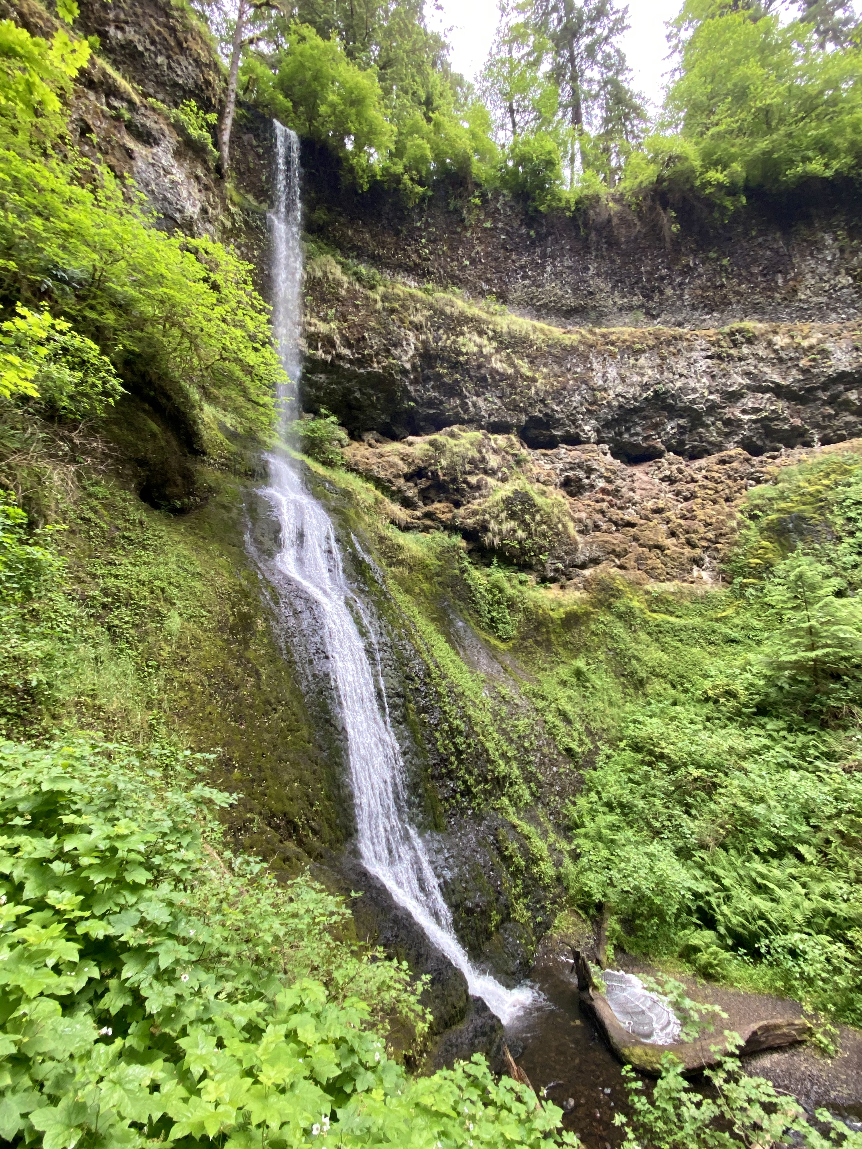
Head down the Winter Falls Trail to reach the base of Winter Falls. This section is just an out-and-back, but it’s worth it! A small bench is there for you at the bottom of the path.
Once you get back to the top continue on the Rim Trail and continue for about another mile. This mile is on a narrow path through a dense forest and the last stretch before you make it back to the parking lot. There are no more waterfalls after Winter Falls so it’s just a straight shot from here. You will cross a paved bike path, dip back into the forest and then cross a road (with a parking lot on your right). Be sure to look for cars here! There are a couple information signs at the beginning of the path across the street. Continue walking down the paved path until you reach the Stone Circle Trailhead. Hit up the nature store for some goodies to your right and the Silver Falls Lodge Café straight ahead for a bite to eat!
To get here, take I-5 south from PDX and then take exit 282A onto OR-551 towards Canby. Drive about 22 miles and then take a left onto Young Street. Keep right to get onto Wilco Highway NE. In 6.4 miles you’ll be driving through Mount Angel and veering left. Drive 4.1 miles to reach Silverton and take a left onto C street. Then in 600 feet take a left on N Water Street/Hwy 214. The road will veer right and turn into Silver Falls Drive NE down the way. There are Silver Falls Tour Route signs everywhere. Continue driving for another 16 miles before you reach the park. You’ll drive past the North Falls Trailhead and Winter Falls Trailhead parking lot on your right- There will be signs for South Falls Day-use Area so just follow the signs.
Google Maps Directions from PDX
- For information about what kind of pass is needed, check out my blog post – Adventure Passes for Pacific Northwest Wanderers entry!
Did you know?! That state parks use to be mainly funded through a gasoline tax? A ballot measure was passed in 1980 that prohibited tax funds being used for anything besides roads. The Oregon Lottery has helped stabilize the budget for the Oregon park system.

3 Comments Add yours